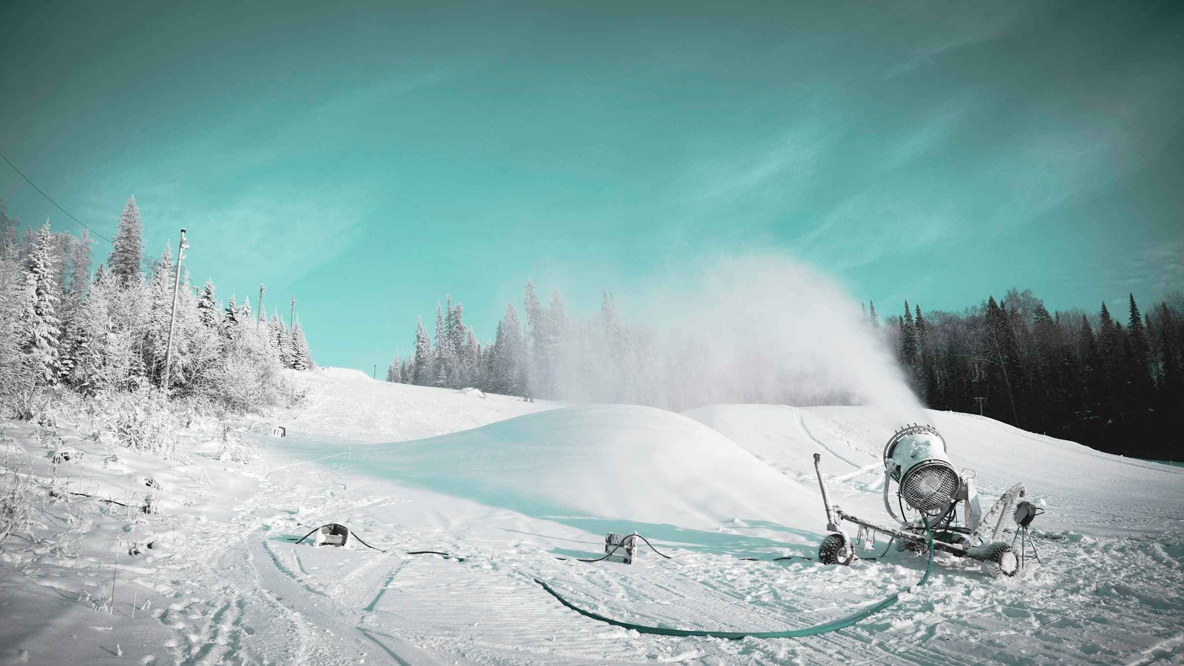
A snowmaking gun blowing a plume of man-made snow across a groomed ski slope lined with frost-covered evergreens

Winter 2026–27 · El Niño explainer

El Niño Winter 2026–27: What It Means for Skiing at Seven Springs

A very strong El Niño is building in the Pacific. Here’s what NOAA’s forecasters, Pittsburgh’s snow records and the resort’s snowmaking say about this ski season — in plain English, with every source linked.

NOAA: El Niño Advisory in effect·Milder-than-normal winter favored·Snowmaking-backed slopes·Sleeps 16+ · free resort shuttle

Last updated: NOAA CPC El Niño discussion of October 8, 2026 · NOAA Winter Outlook of October 15, 2026

CPC updates monthly, on the second Thursday — next on November 12, 2026.

The short answer

Yes, it’s an El Niño winter — and a big one

Yes — winter 2026–27 is an El Niño winter, and a very strong one. NOAA’s Climate Prediction Center puts the odds of El Niño conditions through December–February at essentially 100%, and NOAA’s Winter Outlook tilts western Pennsylvania toward a milder-than-normal winter.

In Pittsburgh’s records, very strong El Niño winters have usually brought less snow than average — less, not none. At Seven Springs the slopes run on snowmaking, so the smart play is a multi-night stay in December, early February or March, with an eye on the forecast as your dates get close.

+2.1°C

How far above normal the key Pacific region ran in September — El Niño starts at +0.5°C

81%

NOAA’s odds that this El Niño is “very strong” in December–February

40–50%

Chance of a warmer-than-normal Dec–Feb at Seven Springs (33% in a typical year)

−10 in.

Pittsburgh’s average Dec–Feb snow shortfall in the six “super” El Niños

ENSO, in plain English

What El Niño actually is

El Niño isn’t a storm. It’s a months-long warm spell in the surface waters of the tropical Pacific that rearranges the jet streams over North America. La Niña is its cool-water opposite, and “ENSO” (El Niño–Southern Oscillation) is the name for the whole cycle. Neither one decides any single day — they tilt the odds for a whole season.

  1. 1 · The Pacific runs warm

    Warm water along the equator

    When the central and eastern equatorial Pacific runs at least 0.5°C warmer than normal for months on end, NOAA calls it El Niño. This fall the key Niño-3.4 region hit +2.1°C, with patches near South America above +4°C.

  2. 2 · The jet streams shift

    Storms get steered south

    That extra heat shifts the jet stream south and east across the U.S., tilting the odds toward stormier weather across the South. Meanwhile the polar jet — the conveyor belt for Arctic air — tends to stay farther north.

  3. 3 · Western PA ends up in between

    Milder, with fewer cold snaps

    NWS Pittsburgh expects storm tracks to favor areas south and east of the city, and cold snaps to be shorter and less intense than usual. That is why NOAA leans the Ohio Valley and Mid-Atlantic warm — and why the precipitation signal here is weak.

How NOAA grades El Niño strength

Weak

+0.5 to +1.0°C

Moderate

+1.0 to +1.5°C

Strong

+1.5 to +2.0°C

Very strong

+2.0°C and up

Forecast this winter

NOAA now officially measures ENSO with a “relative” index (RONI): the Niño-3.4 ocean temperature minus the average of the whole tropics, so long-term ocean warming doesn’t inflate the number. CPC’s middle-of-the-range forecast for December–February is about +2.4°C, and it gives 83% odds that the October–December value tops +2.5°C — stronger than any El Niño since records began in 1950.

This winter’s forecast

What NOAA is saying for 2026–27

Three official sources, read for the Laurel Highlands. Quotes are word for word; every link is in the sources list at the bottom of the page.

NOAA Climate Prediction Center · Oct 8, 2026

Where El Niño stands

Status: El Niño Advisory

“El Niño continues to strengthen, with a strong-to-very strong El Niño likely through January-March 2027 (remaining greater than an 83% chance).”
  • December–February: essentially 100% odds of El Niño — 81% “very strong,” 16% strong, 3% moderate.
  • An El Niño of some strength is favored to last through March–May 2027, with neutral conditions favored by early summer.
  • CPC’s own caveat: with an event this large, El Niño-like impacts are more likely, “though not guaranteed.”

NOAA U.S. Winter Outlook · Oct 15, 2026

What NOAA expects for December–February

  • Temperature: warmer than average is favored for the Midwest, the Mississippi Valley and “much of the East.” At Seven Springs, NOAA’s map shows a 40–50% chance of a warmer-than-normal winter, versus 33% in a typical year — and the warm lean carries into January–March.
  • Precipitation: wetter than average is favored across the South and along the East Coast, while the Ohio Valley gets “equal chances.” The resort sits at the western edge of that wetter zone, with the weakest tilt toward above-normal precipitation; Pittsburgh itself is “equal chances.”
  • Snow: NOAA doesn’t forecast it. In NOAA’s words, the outlook “does not project seasonal snowfall accumulations as snow forecasts are generally not predictable more than a week in advance.”

NWS Pittsburgh · Oct 2, 2026 briefing

The local forecasters’ read

“the frequency, duration, and intensity of cold snaps are favored to be less severe”
“A large winter storm or two cannot be ruled out, but most analogs favor south of I-70.”
“lake-enhanced snow may be more favored compared to normal. Overall, snowfall is still favored below normal for much of the region.”

Reading it together

Put together: a milder-than-normal winter is the most likely outcome — but Seven Springs sits right on the seam of an El Niño winter. The storm track runs along the South and up the East Coast, the drier pattern sits over the Ohio Valley, and the line between them tends to fall across southern Pennsylvania. You can see it in this year’s outlook: Pittsburgh is “equal chances” while the resort lands on the wet edge, and NWS Pittsburgh’s big-storm analogs favor areas south of I-70 — the Turnpike at Donegal, which the resort sits just south of, up on a ridge near 3,000 feet. That’s the side of the line where the region’s biggest El Niño-winter months on the mountain, February 2010 and January 2016, came from. The catch of living on the line: in a mild pattern, some of that moisture comes as rain or mix. Cold snaps still happen in El Niño winters; they just tend to be shorter.

One more NOAA note worth knowing: El Niño plus this winter’s westerly QBO (a high-altitude tropical wind pattern) tends to keep the polar vortex stronger and steadier, which slightly lowers the odds of the vortex disruptions that can send long Arctic cold spells into the East.

What history says

Very strong El Niño winters in western Pennsylvania

Six winters since 1950 have featured a “very strong” El Niño like the one forecast now. Pittsburgh has the longest local record, and NWS Pittsburgh tallied how each one went. Numbers are departures from the 1950–2026 December–February averages (33.5°F, 33.6 inches of snow).

Pittsburgh winter temperature and snowfall in the six very strong El Niño winters since 1950
WinterPeak strength (RONI)Dec–Feb temp vs. avgDec–Feb snow vs. avgFull-season snow
1965–66+2.0°C−2.4°F−0.1 in.48.0 in.
1972–73+2.0°C+0.2°F−15.1 in.26.3 in.
1982–83+2.4°C+3.3°F−8.8 in.30.1 in.
1991–92+2.1°C+1.9°F−13.1 in.33.9 in.
1997–98+2.3°C+3.5°F−14.3 in.24.2 in.
2015–16+2.3°C+4.8°F−9.2 in.29.6 in.
Average—+1.9°F−10.1 in.Normal: 44.1 in.

Pittsburgh International Airport. Departures and peak strength: NWS Pittsburgh, October 2, 2026 briefing. Full-season totals (July–June) and the 1991–2020 normal: NOAA Regional Climate Centers (ACIS).

Five of the six were clearly short on midwinter snow, and five of the six ran warm. The exception is a useful one: 1965–66 landed essentially on normal for December–February (0.1 inch under) and finished the full season above Pittsburgh’s 44.1-inch normal.

There’s also no perfect match for this year. NOAA gives 83% odds that this event becomes the strongest El Niño since 1950, so history is a guide to the odds, not a template.

2009–10 · strong El Niño

The one that buried everybody

Not every El Niño is a dud. 2009–10 was a strong El Niño (peak +1.5, well short of this year’s forecast) and it delivered 77.4 inches at Pittsburgh — the third-snowiest season in the city’s record. Up on the ridge, the Laurel Summit weather station logged 117.8 inches in February 2010 alone.

2015–16 · very strong El Niño

A green December, then a big January

December 2015 was Pittsburgh’s second-warmest December on record, with just 0.3 inch of snow at the airport and 4.1 inches at Laurel Summit. Then the pattern flipped: Laurel Summit picked up 47 inches in January 2016.

2023–24 · moderate El Niño

A thin winter in the city

Pittsburgh got only 16.3 inches all season — its least snowy winter since 1932–33 — after the fifth-warmest December on record. Even so, Laurel Summit recorded 51.1 inches in January 2024.

The ridge isn’t the city

The Laurel Highlands make their own weather. NOAA’s 1991–2020 normal at Laurel Summit (2,730 ft, about 13 miles from the resort) is roughly 142 inches of snow a year, against 44.1 at Pittsburgh’s airport, and Seven Springs lists a 135-inch average. A below-normal winter up here is still a lot more snow than the city sees: in 2015–16, Laurel Summit had about 76 inches in December–February alone, against a normal of about 103.

Outside the extremes, ENSO barely moves the needle here

We sorted every Pittsburgh winter since 1950–51 by NOAA’s ENSO index. La Niña winters averaged 41.5 inches of snow, neutral winters 47.8, and weak-to-moderate El Niños 42.6 — small differences next to the 16-to-80-inch swing from one winter to the next. Only the very strong El Niños (32.0 inches on average) stand apart. The last two winters were both La Niñas, and they went 34.0 inches (2024–25) and then 51.6 (2025–26).

The wild cards are the Great Lakes and the polar vortex. NWS Pittsburgh thinks warm lakes could mean more lake-enhanced snow than usual when cold air does arrive, and a single well-timed storm can make a season. That’s why a mild-leaning winter can still deliver a great week.

What it means for your trip

How to book a ski trip in an El Niño winter

Plan on snowmaking, hope for powder. A mild-leaning winter changes how you book, not whether you go.

Ski the snowmaking-backed core

On the resort’s own trail list, 32 of the 39 runs are marked for snowmaking; the natural-snow-only runs are mostly glades. In a lean natural-snow winter, that’s the terrain you’ll be skiing — and it’s most of the mountain.

Book nights, not a single day

Snowmaking needs cold nights, and El Niño winters still get them — just in shorter spells. A three- or four-night stay gives you room to ski the best day and save a mild or rainy one for the hot tub.

Watch the forecast, not the headlines

Seasonal outlooks tilt the odds for a whole region; they can’t tell you about your weekend. Check our live mountain weather in the week before you come, and the resort’s daily terrain report before you head to the lifts.

Pick the windows that hold up

December (snowmaking season, with the holiday towns lit up), early-February midweek, and March spring skiing. Those are also the stretches we have open right now.

Open ski weeks at Mountain Haven

Each one opens the booking calendar with the dates already filled in.

Early-season weekend

Pre-Christmas on the mountain

Fri Dec 11 – Mon Dec 14, 2026

December is snowmaking season. In a mild-leaning El Niño December, the open terrain grows with every cold night — so come for a long weekend, check the terrain report, and catch the quiet stretch before the holidays.

Check Dec 11–14

Holiday week

Christmas week

Wed Dec 23 – Sun Dec 27, 2026

By Christmas the snow guns have had weeks to work, weather permitting. Four nights gives you slope days, a holiday dinner for the whole crew, and the hot tub under the stars.

Check Christmas Week

Midweek, midwinter

Early-February midweek

Sun Feb 7 – Wed Feb 10, 2027

Deep in the season, with the whole winter’s snowmaking behind it — and midweek is the quiet side of the week on the slopes.

Check Feb 7–10

Spring skiing

Early-March weekend

Fri Mar 5 – Mon Mar 8, 2027

NOAA keeps the warm lean going into late winter, which in March means spring-skiing days: softer snow, longer afternoons, and a deck made for après.

Check Mar 5–8
Two-story vaulted living area with wet bar

If the weather turns

The house carries the day

Every winter has a day when the slopes aren’t the main event. Mountain Haven is built for those: a vaulted great room with a wet bar and big screens, a full kitchen for the long dinner, and a private hot tub on the deck that runs all winter.

  • Private hot tub on the deck — open year-round
  • Vaulted great room, wet bar and big-screen TVs for game nights
  • Sleeps 16+ across 3 bedrooms, a den and the bunk loft
  • Free resort shuttle to the slopes, Main Lodge and dining

Good to know

El Niño & ski-season questions, answered

Is winter 2026–27 an El Niño winter?+

Yes. NOAA’s Climate Prediction Center has an El Niño Advisory in effect, and its October 8, 2026 discussion says: “El Niño continues to strengthen, with a strong-to-very strong El Niño likely through January-March 2027.” CPC puts the odds of El Niño conditions in December–February at essentially 100%, with an 81% chance the event is “very strong.”

Will it be a snowy winter in Pittsburgh and western Pennsylvania?+

The odds lean against it. NOAA’s Winter Outlook favors a warmer-than-normal winter for the region, and NWS Pittsburgh says snowfall is “still favored below normal for much of the region.” In the six very strong El Niños since 1950, Pittsburgh’s December–February snowfall averaged about 10 inches below normal. But NOAA doesn’t forecast seasonal snowfall, and one or two big storms can change a winter.

Does El Niño mean bad skiing at Seven Springs?+

Not necessarily. Most of the mountain has snowmaking — 32 of the 39 runs on the resort’s trail list — and snowmaking runs on cold nights, which still come in El Niño winters, just in shorter spells. The ridge also gets about three times Pittsburgh’s snow in a typical winter. Opening day and the open-terrain count depend on the weather, so check the resort’s live terrain report before you go.

Is El Niño or La Niña better for skiing in Pennsylvania?+

Neither is a sure thing here. Across every winter since 1950–51, Pittsburgh averaged 41.5 inches of snow in La Niña winters and 42.6 in weak-to-moderate El Niños — about the same. The group that clearly lagged was the very strong El Niños, at 32.0 inches. The last two winters were La Niñas, and they swung from 34.0 inches (2024–25) to 51.6 (2025–26).

When should I book a ski trip this winter?+

Aim for the snowmaking-backed stretches that are still open on our calendar: December (including Christmas week), early-February midweeks, and early-March spring skiing. A three- or four-night stay gives you room to work around a mild day.

What if it’s warm or rainy during our stay?+

Have a plan B. The private hot tub on the deck is open year-round, the great room has a wet bar and big-screen TVs for game nights, and the full kitchen handles a long dinner for the whole group. December also brings holiday events across the Laurel Highlands.

How often does this forecast change?+

NOAA’s Climate Prediction Center updates its El Niño discussion monthly, on the second Thursday (the next one is November 12, 2026), and NOAA refreshes its seasonal outlook monthly (next on November 19, 2026). This page reflects the October 2026 updates — follow the source links for anything newer.

Sources

Where every number on this page comes from

  1. ENSO Diagnostic Discussion — NOAA Climate Prediction Center, Issued October 8, 2026. Status, synopsis, Niño-3.4, record-strength odds. This URL always shows the latest issue.
  2. Official ENSO Strength Probabilities — NOAA Climate Prediction Center, Issued October 2026. December–February odds by strength category.
  3. Official RONI Outlook — NOAA Climate Prediction Center, Issued October 2026.
  4. El Nino looms large over U.S. Winter Outlook — NOAA, October 15, 2026.
  5. Prognostic Discussion for Long-Lead Seasonal Outlooks — NOAA Climate Prediction Center, October 15, 2026. Polar vortex / QBO note; El Niño favored through spring 2027.
  6. Seasonal outlook maps, December–February 2026–27 — NOAA Climate Prediction Center, October 15, 2026. Resort-specific odds read from CPC’s published GIS outlook data.
  7. October Monthly Briefing (winter preview + historical “super” El Niños) — National Weather Service, Pittsburgh, October 2, 2026. NWS replaces this file with each monthly briefing.
  8. Relative Oceanic Niño Index (RONI), 1950–present — NOAA Climate Prediction Center, Accessed October 2026.
  9. xmACIS2 climate data: Pittsburgh Area record and Laurel Summit co-op station — NOAA Regional Climate Centers (ACIS), Accessed October 2026. Season totals, monthly snowfall, 1991–2020 normals. Phase averages are our own tally of these records.
  10. Mountain info and trail list — Seven Springs Mountain Resort, Accessed October 2026.

How we sorted the history: each Pittsburgh season (July–June) is classed by NOAA’s December–February RONI value — El Niño at +0.5°C or above, La Niña at −0.5°C or below, “very strong” when the late-fall-to-winter peak reached +2.0°C. Seasonal outlooks give odds for a whole region and season, not a forecast for any specific week.

Plan on snowmaking, hope for powder

Book the ski weeks that hold up in any winter

December, early-February midweeks and March are open now. Pick a few nights, watch the forecast as your dates get close, and let the hot tub handle the rest.

Book direct and skip the Airbnb guest fees (~14%).

Explore by season: